Grab your Crude Oil Charts…a hurricane’s a comin!

Hurricane Irene, the strongest Atlantic storm to threaten the U.S. since 2005, battered the Bahamas on a course that’s expected to take it near North Carolina this weekend and New England next week.
Hurricane watches are in force for the North Carolina coast as 115 miles-per-hour (185 kilometers per hour) winds ripped through the Bahamas, damaging homes, felling trees and triggering flooding, according to the Bahamas Emergency Management Agency. The storm is 670 miles south of Cape Hatteras, North Carolina, the National Hurricane Center in Miami said at 8 a.m., and is moving northwest at 13 mph on a path that will take it along the U.S. Northeast coast this weekend.
“I would expect that by Saturday morning it’s going to be along the borders of North and South Carolina,” said Jim Dale, a Risk Meterologist with High Wycombe, England-based British Weather Services. “Eventually it will come inland north of New York,” he said.
Irene is expected to strengthen later today, the hurricane center said, and could become a Category Four hurricane on the five-step Saffir-Simpson hurricane wind scale, bearing winds of at least 131 mph.
The center issued a hurricane watch for the North Carolina coast from Surf City north to the Virginia border, meaning hurricane-force winds are possible in the next 48 hours. The path could shift 100 miles or more and may change several times, according to Jack Beven, a senior hurricane specialist at the center in Miami.
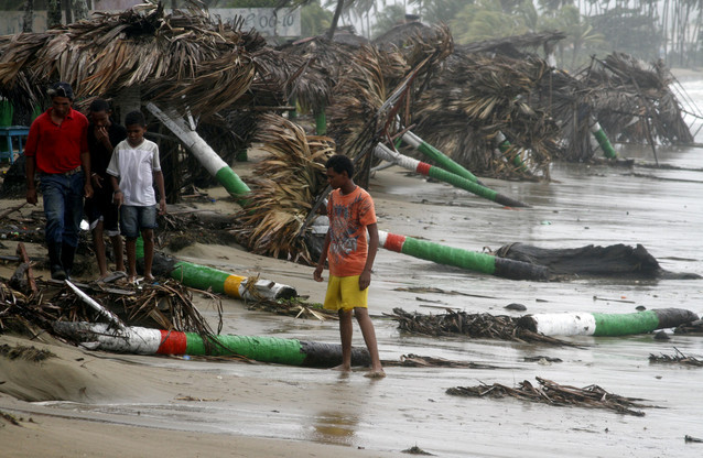 |
People walk along a battered beach in Nagua as winds and rain of Hurricane Irene are still lashing the northern coast of the island of Hispaniola. |
Please Continue Reading Article Here >>>